Thursday, 29 October 2015

Table Mountain

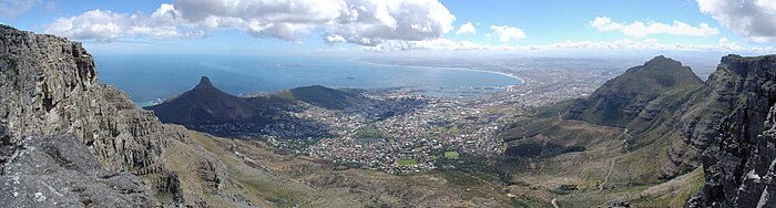
Table Mountain (KhoikhoiHoerikwaggoAfrikaansTafelberg) is a flat-topped mountain forming a prominent landmark overlooking the city of Cape Town in South Africa, and is featured in the Flag of Cape Town and other local government insignia. It is a significant tourist attraction, with many visitors using the cableway or hiking to the top. The mountain forms part of the Table Mountain National Park.

The main feature of Table Mountain is the level plateau approximately 3 kilometres (2 mi) from side to side, edged by impressive cliffs. The plateau, flanked by Devil's Peak to the east and by Lion's Head to the west, forms a dramatic backdrop to Cape Town. This broad sweep of mountainous heights, together with Signal Hill, forms the natural amphitheatre of the City Bowl and Table Bay harbour. The highest point on Table Mountain is towards the eastern end of the plateau and is marked by Maclear's Beacon, a stone cairn built in 1865 by Sir Thomas Maclear for trigonometrical survey. It is 1,086 metres (3,563 ft) above sea level, about 19 metres (62 ft) higher than the cable station at the western end of the plateau.
The cliffs of the main plateau are split by Platteklip Gorge ("Flat Stone Gorge"), which provides an easy and direct ascent to the summit and was the route taken by António de Saldanha on the first recorded ascent of the mountain in 1503.
The flat top of the mountain is often covered by orographic clouds, formed when a south-easterly wind is directed up the mountain's slopes into colder air, where the moisture condenses to form the so-called "table cloth" of cloud. Legend attributes this phenomenon to a smoking contest between the Devil and a local pirate called Van Hunks. When the table cloth is seen, it symbolizes the contest.
Table Mountain is at the northern end of a sandstone mountain range that forms the spine of the Cape Peninsula. To the south of the main plateau is a lower part of the range called the Back Table. On the Atlantic coast of the peninsula, the range is known as the Twelve Apostles. The range continues southwards to Cape Point.


The Great Barrier Reef

The Great Barrier Reef is the world's largest coral reef system composed of over 2,900 individual reefs and 900 islands stretching for over 2,300 kilometres (1,400 mi) over an area of approximately 344,400 square kilometres (133,000 sq mi). The reef is located in the Coral Sea, off the coast of Queensland, Australia.
The Great Barrier Reef can be seen from outer space and is the world's biggest single structure made by living organisms. This reef structure is composed of and built by billions of tiny organisms, known as coralpolyps.It supports a wide diversity of life and was selected as a World Heritage Site in 1981.CNN labeled it one of the seven natural wonders of the world.The Queensland National Trust named it a state icon of Queensland.
A large part of the reef is protected by the Great Barrier Reef Marine Park, which helps to limit the impact of human use, such as fishing and tourism. Other environmental pressures on the reef and its ecosystem include runoff, climate change accompanied by mass coral bleaching, and cyclic population outbreaks of the crown-of-thorns starfish. According to a study published in October 2012 by the Proceedings of the National Academy of Sciences, the reef has lost more than half its coral cover since 1985.
The Great Barrier Reef has long been known to and used by the Aboriginal Australian and Torres Strait Islander peoples, and is an important part of local groups' cultures and spirituality. The reef is a very popular destination for tourists, especially in the Whitsunday Islands and Cairns regions. Tourism is an important economic activity for the region, generating over $3 billion per year.
The Great Barrier Reef is a distinct feature of the East Australian Cordillera division. It includes the smaller Murray Islands.It reaches from Torres Strait (between Bramble Cay, its northernmost island, and the south coast of Papua New Guinea) in the north to the unnamed passage between Lady Elliot Island (its southernmost island) and Fraser Island in the south. Lady Elliot Island is located 1,915 km (1,190 mi) southeast of Bramble Cay as the crow flies.
The Plate tectonic theory indicates Australia has moved northwards at a rate of 7 cm (2.8 in) per year, starting during the Cenozoic.Eastern Australia experienced a period of tectonic uplift, which moved the drainage divide in Queensland 400 km (250 mi) inland. Also during this time, Queensland experienced volcanic eruptions leading to central and shield volcanoes and basalt flows. Some of these became high islands.After thethe Coral Sea Basin formed, coral reefs began to grow in the Basin, but until about 25 million years ago, northern Queensland was still in temperate waters south of the tropics—too cool to support coral growth. The Great Barrier Reef's development history is complex; after Queensland drifted into tropical waters, it was largely influenced by reef growth and decline as sea level changed.
Reefs can increase in diameter by 1 to 3 centimetres (0.39 to 1.18 in) per year, and grow vertically anywhere from 1 to 25 cm (0.39 to 9.84 in) per year; however, they grow only above a depth of 150 metres (490 ft) due to their need for sunlight, and cannot grow above sea level. When Queensland edged into tropical waters 24 million years ago, some coral grew, but a sedimentation regime quickly developed with erosion of the Great Dividing Range; creating river deltas, oozes and turbidites, unsuitable conditions for coral growth. 10 million years ago, the sea level significantly lowered, which further enabled sedimentation. The reef's substrate may have needed to build up from the sediment until its edge was too far away for suspended sediments to inhibit coral growth. In addition, approximately 400,000 years ago there was a particularly warm interglacial period with higher sea levels and a 4 °C (7 °F) water temperature change.

The land that formed the substrate of the current Great Barrier Reef was a coastal plain formed from the eroded sediments of the Great Dividing Range with some larger hills (most of which were themselves remnants of older reefs or, in rare cases, volcanoes).The Reef Research Centre, a Cooperative Research Centre, has found coral 'skeleton' deposits that date back begun growing on the older platform about 20,000 years half a million years. The Great Barrier Reef Marine Park Authority (GBRMPA) considers the earliest evidence of complete reef structures to have been 600,000 years ago.According to the GBRMPA, the current, living reef structure is believed to have ago. The Australian Institute of Marine Science agrees, placing the beginning of the growth of the current reef at the time of the Last Glacial Maximum. At around that time, sea level was 120 metres (390 ft) lower than it is today.

The Great Barrier Reef supports a diversity of life, including many vulnerable or endangered species, some of which may be endemic to the reef system.
Thirty species of whales, dolphins, and porpoises have been recorded in the Great Barrier Reef, including the dwarf minke whale, Indo-Pacific humpback dolphin, and the humpback whale. Large populations of dugongs live there.[More than 1,500 fish species live on the reef, including the clownfish, red bass, red-throat emperor, and several species of snapper and coral trout. Forty-nine species mass spawn, while eighty-four other species spawn elsewhere in their range. Seventeen species of sea snake live on the Great Barrier Reef in warm waters up to 50 metres (160 ft) deep and are more common in the southern than in the northern section. None found in the Great Barrier Reef World Heritage Area are endemic, nor are any endangered.
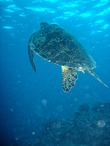
Six species of sea turtles come to the reef to breed: the green sea turtle, leatherback sea turtle, hawksbill turtle, loggerhead sea turtle, flatback turtle, and the olive ridley. The green sea turtles on the Great Barrier Reef have two genetically distinct populations, one in the northern part of the reef and the other in the southern part. Fifteen species of seagrass in beds attract the dugongs and turtles, and provide fish habitat. The most common genera of seagrasses are Halophila and Halodule.
Saltwater crocodiles live in mangrove and salt marshes on the coast near the reef. Nesting has not been reported, and the salt water crocodile population in the GBRWHA is wide-ranging but low densityAround 125 species of shark, stingray, skates or chimaera live on the reef.Close to 5,000 species of mollusc have been recorded on the reef, including the giant clam and various nudibranchs and cone snails. Forty-nine species of pipefish and nine species of seahorse have been recorded. At least seven species of frog inhabit the islands.
Mount Everest

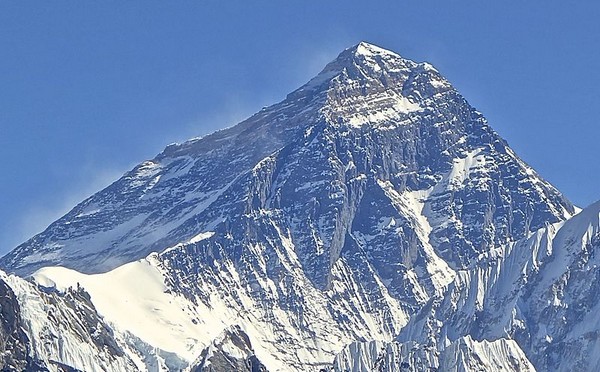
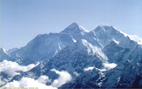
Mount Everest, also known in Nepal as Sagarmāthā and in Tibet as Chomolungma, is Earth's highest mountain. It is located in the Mahalangur mountain range in Nepal. Its peak is 8,848 metres (29,029 ft) above sea level. It is not the furthest summit from the centre of the Earth. That honour goes to Mount Chimborazo, in the Andes.The international border between China (Tibet Autonomous Region) and Nepal runs across Everest's precise summit point. Its massif includes neighbouring peaks Lhotse, 8,516 m (27,940 ft); Nuptse, 7,855 m (25,771 ft) and Changtse, 7,580 m (24,870 ft).
In 1856, the Great Trigonometrical Survey of India established the first published height of Everest, then known as Peak XV, at 29,002 ft (8,840 m). The current official height of 8,848 m (29,029 ft) as recognised by China and Nepal was established by a 1955 Indian survey and subsequently confirmed by a Chinese survey in 1975. In 1865, Everest was given its official English name by the Royal Geographical Society upon a recommendation by Andrew Waugh, the British Surveyor General of India. Waugh named the mountain after his predecessor in the post, Sir George Everest, arguing that there were many local names, against the opinion of Everest.
Mount EverestMount Everest attracts many highly experienced mountaineers as well as capable climbers willing to hire professional guides. There are two main climbing routes, one approaching the summit from the southeast in Nepal (known as the standard route) and the other from the north in Tibet. While not posing substantial technical climbing challenges on the standard route, Everest presents dangers such as altitude sickness, weather, wind as well as significant objective hazards from avalanches and the Khumbu Icefall.The first recorded efforts to reach Everest's summit were made by British mountaineers. With Nepal not allowing foreigners into the country at the time, the British made several attempts on the north ridge route from the Tibetan side. After the first reconnaissance expedition by the British in 1921 reached 7,000 m (22,970 ft) on the North Col, the 1922 expedition pushed the North ridge route up to 8,320 m (27,300 ft) marking the first time a human had climbed above 8,000 m (26,247 ft). Tragedy struck on the descent from the North col when seven porters were killed in an avalanche. The 1924 expedition resulted in the greatest mystery on Everest to this day: George Mallory and Andrew Irvine made a final summit attempt on June 8 but never returned, sparking debate as to whether they were the first to reach the top. They had been spotted high on the mountain that day but disappeared in the clouds, never to be seen again, until Mallory's body was found in 1999 at 8,155 m (26,755 ft) on the North face. Tenzing Norgay and Edmund Hillary made the first official ascent of Everest in 1953 using the southeast ridge route. Tenzing had reached 8,595 m (28,199 ft) the previous year as a member of the 1952 Swiss expedition. The Chinese mountaineering team of Wang Fuzhou,Gonpo and Qu Yinhua made the first reported ascent of the peak from the North Ridge on May 25, 1960.


Top 10 spots to see nature

Our world is full of wonders. From the evolution of Human life to till date , People are busy in exploring these wonders. Many of them are still hidden and undiscovered yet. These spectacular structures always inspires us and shows us that ther is a a power who created all these mighty things. Compiling a list of top 10 natural wonders of the world is never an easy task because various lists of the Wonders of the World have been compiled from ancient to the present day, to catalogue the most spectacular natural wonders and man-made structures. Similar to the other lists of wonders, there is no consensus on a list of ten natural wonders of the world, and there has been a debate over how large the list should be. We did our best to compile this top 10 natural wonders of the world in a list. Hope you will like it. How many of them you have visited? Have a read and tell us in comments.

10. Ha Long Bay

Top 10 Natural Wonders
Ha Long Bay, in the Gulf of Tonkin, includes some 1,600 islands and islets, forming a spectacular seascape of limestone pillars. Because of their precipitous nature, most of the islands are uninhabited and unaffected by a human presence. The site’s outstanding scenic beauty is complemented by many nature lovers. The bay features thousands of limestone karsts and isles in various sizes and shapes. The limestone in this bay has gone through 500 million years of formation in different conditions and environments. The evolution of the karst in this bay has taken 20 million years under the impact of the tropical wet climate. Ha Long Bay is home to 14 endemic floral species and 60 endemic faunal species. Historical research surveys have shown the presence of prehistorical human beings in this area tens of thousands years ago.

9. Table Mountain

Top 10 Natural Wonders
Table Mountain is a flat-topped mountain forming a prominent landmark overlooking the city of Cape Town in South Africa. It is one of the New natural Wonders of world. It is a significant tourist attraction, with many visitors using the cableway or hiking to the top.

8. Puerto Princesa Underground River

Top 10 Natural Wonders
The Puerto Princesa Subterranean River National Park is one of the most distinguished protected areas of the Philippines. It is located some 360 miles southwest of Manila. It was established as a National Park in 1971 primarily to protect and preserve the intact old growth forest, interesting wildlife, pristine white sand beaches, unspoiled natural beauty and one of the most impressive caves systems in the world.

7. Jeju Island

Top 10 Natural Wonders
Jejudo is a volcanic island, 130 km from the southern coast of Korea. The largest island and smallest province in Korea, the island has a surface area of 1,846 sqkm. The island contains the natural World Heritage Site Jeju Volcanic Island and Lava Tubes. A central feature of Jeju's Hallasan, the tallest mountain in South Korea and a dormant volcano, which rises 1,950 m above sea level.

6. Parícutin

Top 10 Natural Wonders
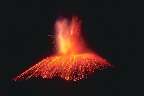
Parícutin (volcano) is a cinder cone volcano in the Mexican state of Michoacán. The volcano is unique in the fact that its evolution from creation to extinction was witnessed, observed and studied by human beings. It appears on many versions of the Natural Wonders of the World. Parícutin is part of the Michoacán-Guanajuato volcanic field, which covers much of west central Mexico. It is part of the Ring of Fire.
5. Iguazu Falls
magic of nature
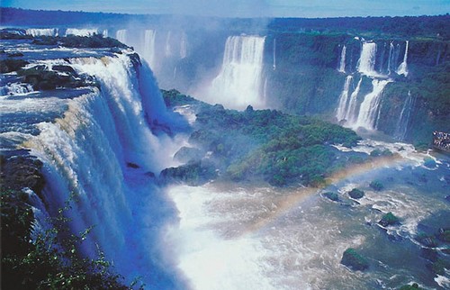
The Garganta del Diablo (Devil’s throat) with its U-shape is undoubtedly the highlight of these majestic waterfalls. It is 82 metres high, 150 metres wide and 700 metres long, while the rest of the falls average 64 metres. Iguazu Falls has long been one of Argentina and Brazil’s most popular touristic destinations. Over 2000 species of plants, 400 of birds and 70 mammals have been registered in the area.

4. Aurora

Aurora
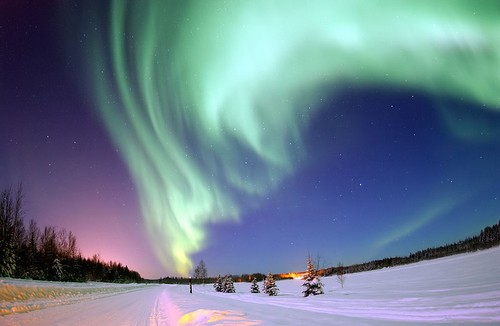
One of the greatest natural wonders, Aurora. The auroras, also known as the Northern Lights, are naturally occurring lights that create intriguing and spectacular displays in the sky. The aurora lights frequently appear as diffused glow lighting up the horizon. The most amazing sight is when the northern lights appears as waves across the sky; it is almost as if the lights are dancing.

3. Mount Everest

Top 10 Natural Wonders
Mount Everest is the highest mountain in the world with the summit reaching a peak of 29,029 feet (8,848 m). It is located in the Himalayan mountain range on the border between Nepal and Tibet, China. Mt. Everest has a great deal of history behind it. It was named after Sir George Everest, surveyor-general of India. On May 28, 1953 Sir Edmund Hillary and Tenzing Norgay were left behind by their companions. They hoped to be the first to climb the world’s highest mountain.The next day they became the first people in the world to climb Mount Everest.to see details of mount everest

2. Great Barrier Reef

Top 10 Natural Wonders
Located in the Coral Sea, off the coast of Queensland, Australia. The great barrier reef is the world’s largest individual formation created by living organisms. As the largest coral reef in the world, the Great Barrier Reef includes over 900 islands, over 2,900 separate reefs, and supports one of the most diverse ecosystems in the world. It is possible one of the grandest natural wonders in the world. It is the only wonder of nature that may be visible recognized from outer space.to see details [click here]

1. Grand Canyon

Top10 Natural Wonders
The Grand Canyon is one of the most remarkable natural wonders in the world. Located in the state of Arizona, USA, it is one of the deepest gorges on Earth with an average depth of one mile (1.6km) and an average width of ten miles (16km). The canyon was carved over the past 6 million years by the action of the Colorado River as it drops over 2,200 feet (670m) along the 277-mile (446 km) length of the gorge. For thousands of years, the area has been continuously inhabited by Native Americans who built settlements within the canyon and its many caves. The Pueblo people considered the Grand Canyon a holy site and made pilgrimages to it.